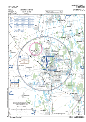


LHNY - Nyiregyhaza
Located in Nyiregyhaza, Hungary
ICAO - LHNY, IATA -
Data provided by AirmateGeneral information
Coordinates: N47°58'46" E21°41'32"
Elevation is 337 feet MSL.
Magnetic variation is 6° East View others Airports in Szabolcs-Szatmár-Bereg
Operational data
Special qualification required
Current time UTC:
Current local time:
Weather at : LHDC - Debrecen International Airport ( 55 km )
METAR: LHDC 291115Z AUTO VRB04KT CAVOK 25/11 Q1010 NOSIG
TAF: TAF LHDC 291115Z 2912/2921 35008KT CAVOK TEMPO 2912/2921 VRB18G28KT 4000 SHRA TSRA BKN040CB
Communications frequencies: [VIEW]
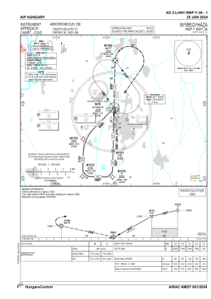
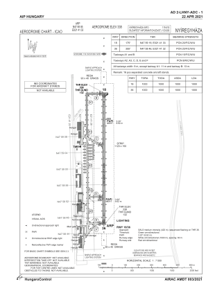
Runways:
| RWY identifier | QFU | Length (ft) | Width (ft) | Surface | LDA (ft) |
| 18 | 181° | 3281 | 66 | ASPH | 3281 |
| 36 | 1° | 3281 | 66 | ASPH | 3281 |
Airport contact information
Address: Nyiregyhaza Hungary