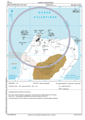
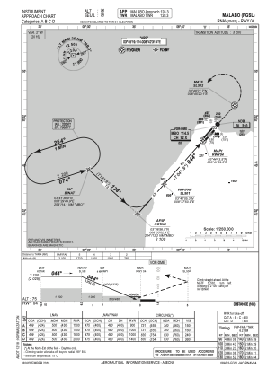
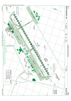


FGSL - Malabo
Located in Malabo, Equatorial Guinea
ICAO - FGSL, IATA - SSG
Data provided by AirmateGeneral information
Coordinates: N3°45'19" E8°42'31"
Elevation is 76 feet MSL.
View others Airports in Bioko Norte
Operational data
Special qualification required
Current time UTC:
Current local time:
Communications frequencies: [VIEW]
Runways:
| RWY identifier | QFU | Length (ft) | Width (ft) | Surface | LDA (ft) |
| 04 | 42° | 9646 | 148 | UNK | |
| 22 | 222° | 9646 | 148 | UNK |
Airport contact information
Address: Malabo Equatorial Guinea