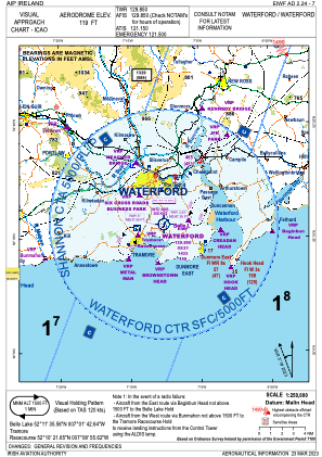
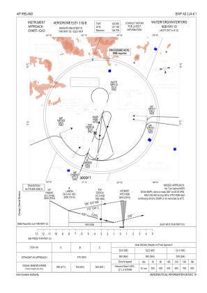
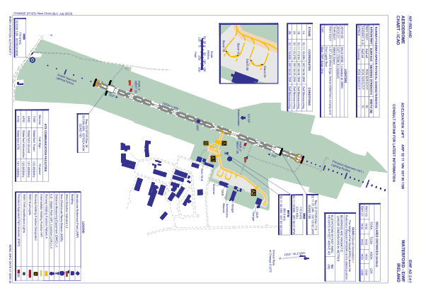


EIWF - Waterford
Located in Waterford, Ireland
ICAO - EIWF, IATA - WAT
Data provided by AirmateGeneral information
Coordinates: N52°11'14" W7°5'13"
Elevation is 119 feet MSL.
Magnetic variation is -3° East View others Airports in County Waterford
Operational data
Special qualification required
Current time UTC:
Current local time:
Weather
METAR: EIWF 041630Z 32015G27KT 280V010 9999 SCT040 16/04 Q1010
TAF: TAF EIWF 041400Z 0415/0424 31014KT 9999 FEW012 SCT025 TEMPO 0415/0417 32016G26KT BECMG 0422/0424 28007KT
Communications frequencies: [VIEW]
Runways:
| RWY identifier | QFU | Length (ft) | Width (ft) | Surface | LDA (ft) |
| 03 | 21° | 4701 | 98 | ASPH | 4406 |
| 21 | 201° | 4701 | 98 | ASPH | 4232 |
Airport contact information
Address: Waterford Ireland
