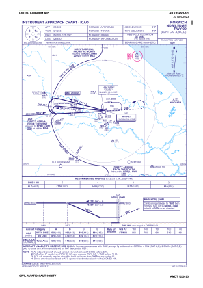
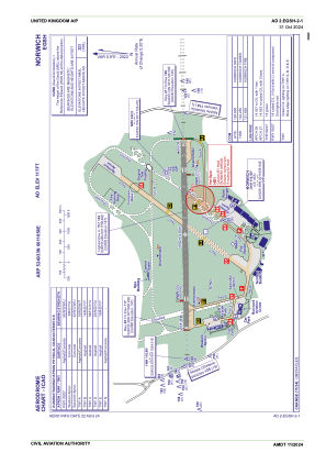


EGSH - Norwich
Located in Norwich, United Kingdom
ICAO - EGSH, IATA - NWI
Data provided by AirmateGeneral information
Coordinates: N52°40'33" E1°16'58"
Elevation is 117 feet MSL.
View others Airports in England
Operational data
Special qualification required
Current time UTC:
Current local time:
Communications frequencies: [VIEW]
Runways:
| RWY identifier | QFU | Length (ft) | Width (ft) | Surface | LDA (ft) |
| 09 | 89° | 6043 | 148 | ASP | |
| 27 | 269° | 6043 | 148 | ASP |
Airport contact information
Address: Norwich United Kingdom
