


6B4 - Frankfort-Highland
Located in Utica/Frankfort, United States
ICAO - 6B4, IATA -
Data provided by AirmateGeneral information
Coordinates: N43°0'58" W75°10'10"
Elevation is 1325 feet MSL.
Magnetic variation is -13° East View others Airports in New York
Operational data
Special qualification required
Current time UTC:
Current local time:
Communications frequencies: [VIEW]
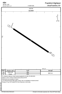
Runways:
| RWY identifier | QFU | Length (ft) | Width (ft) | Surface | LDA (ft) |
| 13 | 123° | 2750 | 60 | ASPH | |
| 31 | 303° | 2750 | 60 | ASPH |
Airport contact information
Address: Utica/Frankfort United States