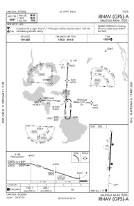


X23 - Umatilla Muni
Located in Umatilla, United States
ICAO - X23, IATA -
Data provided by AirmateGeneral information
Coordinates: N28°55'27" W81°39'7"
Elevation is 107 feet MSL.
Magnetic variation is -06° East View others Airports in Florida
Operational data
Special qualification required
Current time UTC:
Current local time:
Weather at : KLEE - Leesburg Intl ( 19 km )
METAR: KLEE 281053Z 07006KT 10SM CLR 19/15 A3017 RMK AO2 SLP216 T01890150
TAF: KLEE 280521Z 2806/2906 09009G16KT P6SM BKN040 BKN250 FM281500 11011G20KT P6SM SCT050 SCT250 FM290200 08010KT P6SM BKN250 FM290500 09005KT P6SM FEW040 FEW150 SCT250
Communications frequencies: [VIEW]
Runways:
| RWY identifier | QFU | Length (ft) | Width (ft) | Surface | LDA (ft) |
| 19 | 0° | 2500 | 60 | ASPH |
Airport contact information
Address: Umatilla United States
