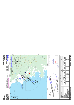
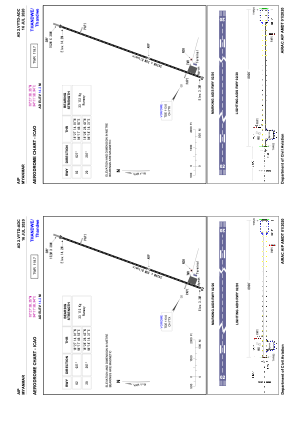


VYTD - Thandwe
Located in Thandwe, Myanmar
ICAO - VYTD, IATA - SNW
Data provided by AirmateGeneral information
Coordinates: N18°27'38" E94°17'59"
Elevation is 47 feet MSL.
View others Airports in Rakhine State
Operational data
Special qualification required
Current time UTC:
Current local time:
Weather at : - ( 0 km )
METAR: KAFP 060951Z AUTO 18003KT 10SM OVC007 20/20 A3004 RMK AO2 P0001 T02020196
Communications frequencies: [VIEW]
Runways:
| RWY identifier | QFU | Length (ft) | Width (ft) | Surface | LDA (ft) |
| 02 | 21° | 8002 | 98 | BIT | |
| 20 | 201° | 8002 | 98 | BIT |
Airport contact information
Address: Thandwe Myanmar