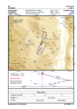
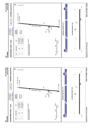


VYLK - Loikaw
Located in Loikaw, Myanmar
ICAO - VYLK, IATA - LIW
Data provided by AirmateGeneral information
Coordinates: N19°41'30" E97°12'54"
Elevation is 2932 feet MSL.
View others Airports in Kayah State
Operational data
Special qualification required
Current time UTC:
Current local time:
Weather at : - ( 0 km )
METAR: KQFX 060910Z AUTO 17002KT 9999 OVC016 14/13 A2974 RMK A02 TSNO
Communications frequencies: [VIEW]
Runways:
| RWY identifier | QFU | Length (ft) | Width (ft) | Surface | LDA (ft) |
| 01 | 5° | 6998 | 75 | BIT | |
| 19 | 185° | 6998 | 75 | BIT |
Airport contact information
Address: Loikaw Myanmar