


VVCS - Co Ong Airport
Located in Con Ong, Viet Nam
ICAO - VVCS, IATA - VCS
Data provided by AirmateGeneral information
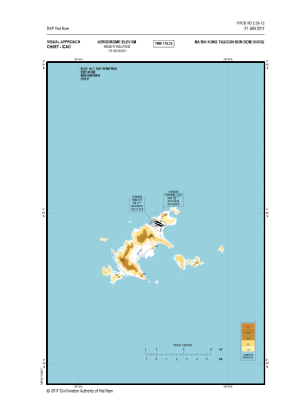
Coordinates: N8°43'59" E106°37'47"
Elevation is 20 feet MSL.
View others Airports in Hoa Binh
Operational data
Special qualification required
Current time UTC:
Current local time:
Weather at : - ( 0 km )
METAR: KXSA 270415Z AUTO 09004KT 10SM OVC060 11/06 A3047 RMK AO2 T01070062
Communications frequencies: [VIEW]
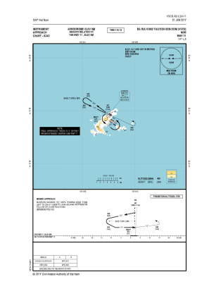
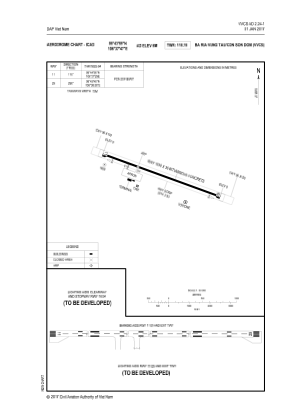
Runways:
| RWY identifier | QFU | Length (ft) | Width (ft) | Surface | LDA (ft) |
| 11 | 0° | 6004 | 100 | ASP | |
| 29 | 0° | 6004 | 100 | ASP |
Airport contact information
Address: Con Ong Viet Nam