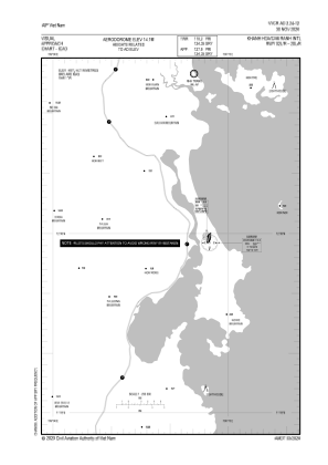
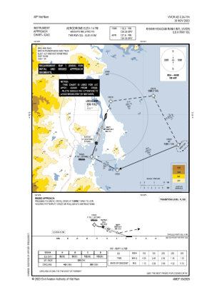
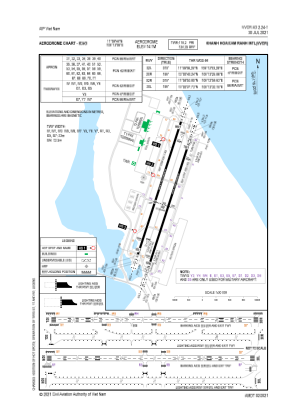


VVCR - Khanh Hoa / Cam Ranh International
Located in Cam Ranh, Viet Nam
ICAO - VVCR, IATA - CXR
Data provided by AirmateGeneral information
Coordinates: N11°59'44" E109°13'6"
Elevation is 43 feet MSL.
View others Airports in Khanh Hoa
Operational data
Special qualification required
Current time UTC:
Current local time:
Weather
TAF: TAF VVCR 040500Z 0406/0506 13012KT 9999 FEW017 BECMG 0413/0414 30005KT BECMG 0503/0504 14010KT
Communications frequencies: [VIEW]
Runways:
| RWY identifier | QFU | Length (ft) | Width (ft) | Surface | LDA (ft) |
| 02L | 19° | 10010 | 148 | UNK | |
| 20R | 199° | 10010 | 148 | UNK | |
| 02R | 19° | 10000 | 148 | UNK | |
| 20L | 199° | 10000 | 148 | UNK |
Airport contact information
Address: Cam Ranh Viet Nam