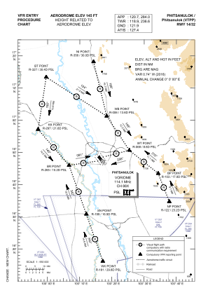
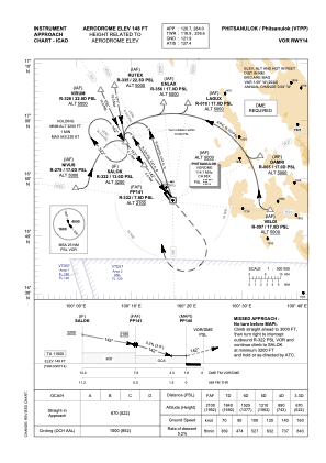
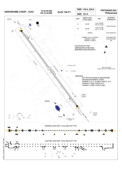


VTPP - Phitsanulok / Phitsanulok Airport
Located in Phitsanulok, Thailand
ICAO - VTPP, IATA - PHS
Data provided by AirmateGeneral information
Coordinates: N16°46'59" E100°16'45"
Elevation is 145 feet MSL.
View others Airports in Phitsanulok Province
Operational data
Special qualification required
Current time UTC:
Current local time:
Weather
METAR: VTPP 041200Z 18003KT 5000 HZ NSC 35/23 Q1003 NOSIG
TAF: TAF VTPP 041100Z 0412/0512 15005KT 8000 FEW030 BECMG 0419/0421 25005KT
Communications frequencies: [VIEW]
Runways:
| RWY identifier | QFU | Length (ft) | Width (ft) | Surface | LDA (ft) |
| 14 | 144° | 9843 | 148 | ASP | |
| 32 | 324° | 9843 | 148 | ASP |
Airport contact information
Address: Phitsanulok Thailand