


VTCN - Nan / Nan Nakhon Airport
Located in Nan, Thailand
ICAO - VTCN, IATA - NNT
Data provided by AirmateGeneral information
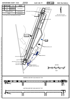
Coordinates: N18°48'28" E100°47'0"
Elevation is 685 feet MSL.
View others Airports in Nan Province
Operational data
Special qualification required
Current time UTC:
Current local time:
Weather
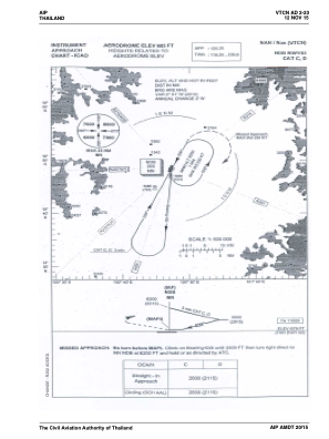
METAR: VTCN 300600Z 17005KT 110V210 9999 FEW025 33/26 Q1004 NOSIG
TAF: TAF VTCN 300500Z 3006/3106 19005KT 9999 SCT025 TEMPO 3006/3012 -TSRA FEW020CB BKN025 TEMPO 3014/3020 -TSRA FEW020CB BKN025 BECMG 3016/3018 36005KT BECMG 3101/3103 18005KT
Communications frequencies: [VIEW]
Runways:
| RWY identifier | QFU | Length (ft) | Width (ft) | Surface | LDA (ft) |
| 02 | 20° | 6808 | 148 | ASP | |
| 20 | 200° | 6808 | 148 | ASP |
Airport contact information
Address: Nan Thailand