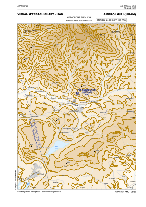


UGAM - Ambrolauri
Located in Ambrolauri, Georgia
ICAO - , IATA -
Data provided by AirmateGeneral information
Coordinates: N42°31'37" E43°8'8"
Elevation is 1784 feet MSL.
Magnetic variation is 7° East View others Airports in Shida Kartli
Operational data
Special qualification required
Current time UTC:
Current local time:
Communications frequencies: [VIEW]
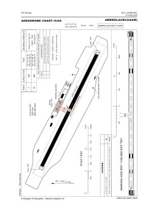
Runways:
| RWY identifier | QFU | Length (ft) | Width (ft) | Surface | LDA (ft) |
| 11 | 115° | 3609 | 98 | CONC+ASPH | 3609 |
| 29 | 295° | 3609 | 98 | CONC+ASPH | 3609 |
Airport contact information
Address: Ambrolauri Georgia