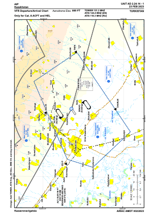
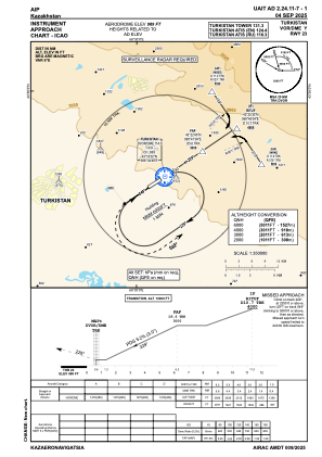
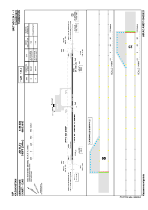


UAIT - Turkistan
Located in Turkistan, Kazakhstan
ICAO - , IATA -
Data provided by AirmateGeneral information
Coordinates: N43°18'40" E68°33'1"
Elevation is 989 feet MSL.
Magnetic variation is 6° East View others Airports in South Kazakhstan
Operational data
Special qualification required
Current time UTC:
Current local time:
Weather at : - ( 0 km )
METAR: YPGV 291101Z AUTO 12006KT 8000 -SHRA SCT014 BKN018 BKN023 27/25 Q1011
Communications frequencies: [VIEW]
Runways:
| RWY identifier | QFU | Length (ft) | Width (ft) | Surface | LDA (ft) |
| 05 | 56° | 10827 | 148 | ASPH | 10827 |
| 23 | 236° | 10827 | 148 | ASPH | 10827 |
Airport contact information
Address: Turkistan Kazakhstan