


SN32 - Rands
Located in Belle Plaine, United States
ICAO - SN32, IATA -
Data provided by AirmateGeneral information
Coordinates: N37°25'32" W97°16'12"
Elevation is 1208 feet MSL.
Magnetic variation is 07° East View others Airports in Kansas
Operational data
Special qualification required
Current time UTC:
Current local time:
Weather at : KEGT - Wellington Muni ( 15 km )
METAR: KEGT 260255Z AUTO 11019G27KT 10SM OVC006 14/13 A2973 RMK AO2 T01440133
Communications frequencies: [VIEW]
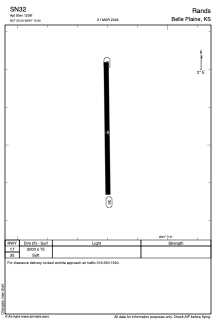
Runways:
| RWY identifier | QFU | Length (ft) | Width (ft) | Surface | LDA (ft) |
| 17 | 179° | 2000 | 75 | GRASS | |
| 35 | 359° | 2000 | 75 | GRASS |
Airport contact information
Address: Belle Plaine United States