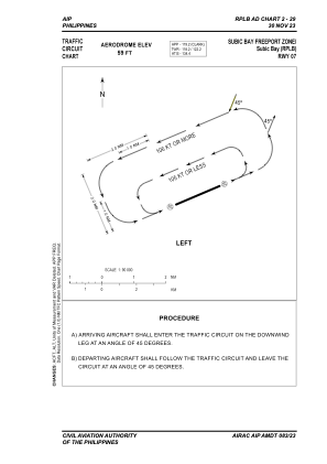
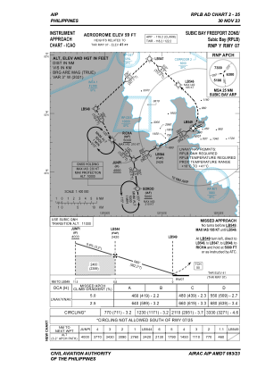
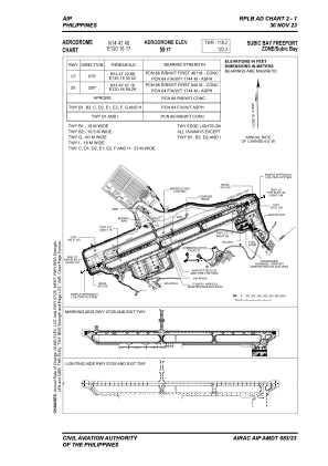


RPLB - Subic Bay International Airport
Located in Subic Bay, Philippines
ICAO - RPLB, IATA - SFS
Data provided by AirmateGeneral information
Coordinates: N14°47'40" E120°16'17"
Elevation is 59 feet MSL.
Magnetic variation is -3° East View others Airports in Zambales
Operational data
Special qualification required
Current time UTC:
Current local time:
Weather
METAR: RPLB 030100Z 07008KT 340V100 9999 FEW020 33/21 Q1012 NOSIG RMK A2988
TAF: TAF RPLB 022300Z 0300/0324 07009KT 9999 FEW020 TX37/0306Z TN26/0321Z TEMPO 0300/0306 09012KT
Communications frequencies: [VIEW]
Runways:
| RWY identifier | QFU | Length (ft) | Width (ft) | Surface | LDA (ft) |
| 07 | 67° | 9006 | 148 | CONC | 9006 |
| 25 | 247° | 9006 | 148 | CONC | 9006 |
Airport contact information
Address: Subic Bay Philippines