


ROKR - Kerama
Located in , Japan
ICAO - ROKR, IATA - KJP
Data provided by AirmateGeneral information
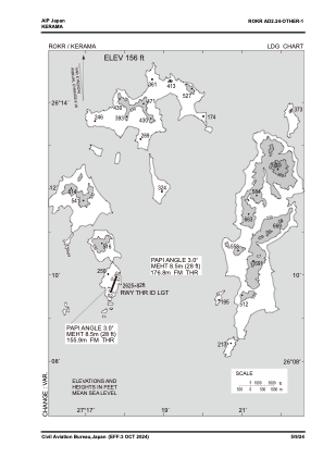
Coordinates: N26°10'6" E127°17'36"
Elevation is 156 feet MSL.
View others Airports in Okinawa Prefecture
Operational data
Special qualification required
Current time UTC:
Current local time:
Weather at : ROAH - Naha ( 35 km )
METAR: ROAH 280100Z 16006KT 9999 FEW008 FEW020CB SCT060 29/24 Q1012 RMK 1ST008 1CB020 3AC060 A2988 CB SW
TAF: TAF AMD ROAH 280047Z 2800/2906 17008KT 9999 FEW008 BKN012 TEMPO 2802/2806 4000 TSRA FEW006 BKN010 FEW020CB TEMPO 2811/2821 FEW006 BKN008
Communications frequencies: [VIEW]
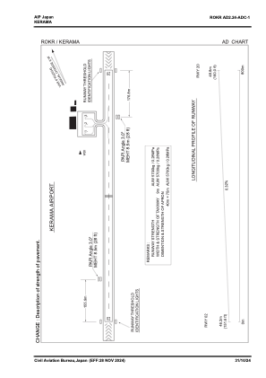
Runways:
| RWY identifier | QFU | Length (ft) | Width (ft) | Surface | LDA (ft) |
| 02 | 0° | 2625 | 82 | UNK | |
| 20 | 0° | 2625 | 82 | UNK |
Airport contact information
Address: Japan