


ROKJ - Kumejima
Located in , Japan
ICAO - ROKJ, IATA - UEO
Data provided by AirmateGeneral information
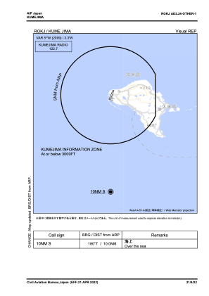
Coordinates: N26°21'49" E126°42'50"
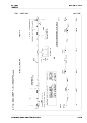
Elevation is 23 feet MSL.
View others Airports in Okinawa Prefecture
Operational data
Special qualification required
Current time UTC:
Current local time:
Communications frequencies: [VIEW]
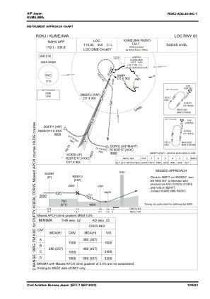
Runways:
| RWY identifier | QFU | Length (ft) | Width (ft) | Surface | LDA (ft) |
| 03 | 21° | 6562 | 148 | ASP | |
| 21 | 201° | 6562 | 148 | ASP |
Airport contact information
Address: Japan