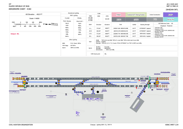


OIZH - Zahedan / International
Located in Zahedan, Iran, Islamic Republic of
ICAO - OIZH, IATA - ZAH
Data provided by AirmateGeneral information
Coordinates: N29°28'24" E60°54'12"
Elevation is 4523 feet MSL.
View others Airports in Sistan and Baluchestan Province
Operational data
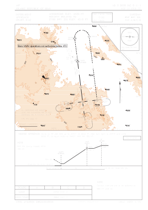
Special qualification required
Current time UTC:
Current local time:
Weather
METAR: OIZH 031500Z 25010KT 9999 FEW040 23/09 Q1010 A2983 NOSIG
TAF: TAF OIZH 031100Z 0312/0418 24016KT 7000 FEW035CB SCT040 BKN100 TEMPO 0312/0316 24026G36KT 1000 SA FEW035CB SCT040 SCT100 BECMG 0315/0317 24010KT FEW035 BKN100 BECMG 0406/1408 24014KT TEMPO 0409/0418 24018G28KT 3000 SA FEW035CB SCT100
Communications frequencies: [VIEW]
Runways:
| RWY identifier | QFU | Length (ft) | Width (ft) | Surface | LDA (ft) |
| 17R | 173° | 13996 | 148 | UNK | |
| 35L | 353° | 13996 | 148 | UNK | |
| 17L | 173° | 13993 | 148 | ASP | |
| 35R | 353° | 13993 | 148 | ASP |
Airport contact information
Address: Zahedan Iran, Islamic Republic of