


OICS - Sanandaj / Secondary International Aerodrome
Located in Sanandaj, Iran, Islamic Republic of
ICAO - OICS, IATA - SDG
Data provided by AirmateGeneral information
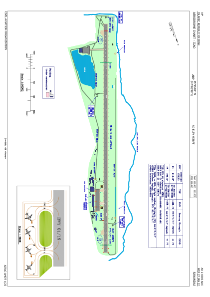
Coordinates: N35°15'3" E47°0'40"
Elevation is 4528 feet MSL.
View others Airports in Kordestan Province
Operational data
Special qualification required
Current time UTC:
Current local time:
Weather
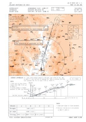
METAR: OICS 041100Z 17008KT 9999 FEW030CB SCT035 18/06 Q1011 A2988
Communications frequencies: [VIEW]
Runways:
| RWY identifier | QFU | Length (ft) | Width (ft) | Surface | LDA (ft) |
| 01 | 18° | 9905 | 148 | ASP | |
| 19 | 198° | 9905 | 148 | ASP |
Airport contact information
Address: Sanandaj Iran, Islamic Republic of