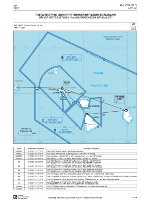
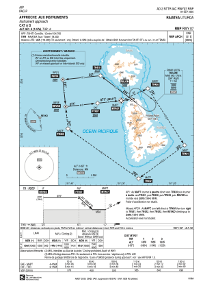
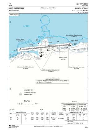


NTTR - Raiatea Uturoa
Located in Ururoa, French Polynesia
ICAO - NTTR, IATA - RFP
Data provided by AirmateGeneral information
Coordinates: S16°43'23" W151°28'1"
Elevation is 6 feet MSL.
Magnetic variation is 12.69° East View others Airports in (unassigned)
Operational data
Special qualification required
Current time UTC:
Current local time:
Communications frequencies: [VIEW]
Runways:
| RWY identifier | QFU | Length (ft) | Width (ft) | Surface | LDA (ft) |
| 07 | 84° | 4593 | 98 | ASPH | 4541 |
| 25 | 264° | 4593 | 98 | ASPH | 4541 |
Airport contact information
Address: Ururoa French Polynesia
