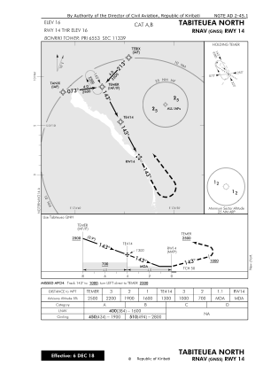


NGTE - Tabiteuea North
Located in , Kiribati
ICAO - NGTE, IATA - TBF
Data provided by AirmateGeneral information
Coordinates: S1°13'25" E174°46'33"
Elevation is 16 feet MSL.
Magnetic variation is 10° East View others Airports in Gilbert Islands
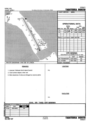
Operational data
Special qualification required
Current time UTC:
Current local time:
Weather at : - ( 0 km )
METAR: KAFP 051231Z AUTO 21004KT 3SM +RA SCT012 BKN020 OVC055 20/19 A3008 RMK AO2 P0001 T01970191
Communications frequencies: [VIEW]
Runways:
| RWY identifier | QFU | Length (ft) | Width (ft) | Surface | LDA (ft) |
| 14 | 153° | 3399 | 98 | COR | |
| 32 | 333° | 3399 | 98 | COR |
Airport contact information
Address: Kiribati