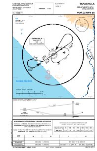
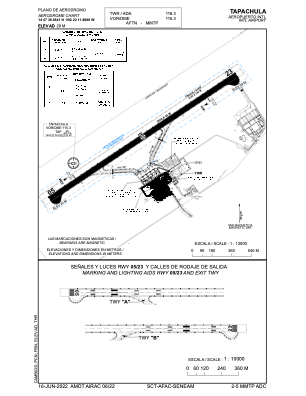


MMTP - Tapachula Aeropuerto Internacional
Located in Tapachula, Mexico
ICAO - MMTP, IATA - TAP
Data provided by AirmateGeneral information
Coordinates: N14°47'40" W92°22'12"
Elevation is 97 feet MSL.
View others Airports in Chiapas
Operational data
Special qualification required
Current time UTC:
Current local time:
Communications frequencies: [VIEW]
Runways:
| RWY identifier | QFU | Length (ft) | Width (ft) | Surface | LDA (ft) |
| 05 | 56° | 6562 | 148 | ASP | |
| 23 | 236° | 6562 | 148 | ASP |
Airport contact information
Address: Tapachula Mexico