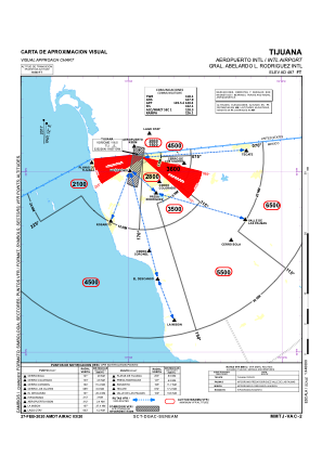
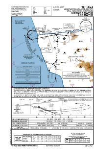
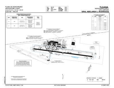


MMTJ - Tijuana Aeropuerto Internacional Gral. Abelardo L. Rodriguez
Located in Tijuana, Mexico
ICAO - MMTJ, IATA - TIJ
Data provided by AirmateGeneral information
Coordinates: N32°32'28" W116°58'12"
Elevation is 487 feet MSL.
View others Airports in Baja California
Operational data
Special qualification required
Current time UTC:
Current local time:
Weather
METAR: MMTJ 021940Z 00000KT 6SM SKC 21/12 A2992 RMK HZY
TAF: TAF COR MMTJ 021859Z 0218/0318 28010KT 4SM HZ BKN015 TX21/0222Z TN14/0312Z FM022000 28010KT 6SM HZ SKC FM030300 00000KT 4SM HZ BKN015 FM030900 00000KT 3SM BR OVC010 FM031600 00000KT 4SM HZ OVC015
Communications frequencies: [VIEW]
Runways:
| RWY identifier | QFU | Length (ft) | Width (ft) | Surface | LDA (ft) |
| 09 | 99° | 9715 | 148 | CON | |
| 27 | 279° | 9715 | 148 | CON |
Airport contact information
Address: Tijuana Mexico