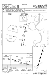


M32 - Lake Village Muni
Located in Lake Village, United States
ICAO - M32, IATA -
Data provided by AirmateGeneral information
Coordinates: N33°20'48" W91°18'56"
Elevation is 126 feet MSL.
Magnetic variation is -01° East View others Airports in Arkansas
Operational data
Special qualification required
Current time UTC:
Current local time:
Weather at : KGLH - Greenville Mid-Delta ( 34 km )
METAR: KGLH 281953Z 19010KT 10SM FEW045 SCT050 28/19 A2999 RMK AO2 SLP159 T02830194
TAF: KGLH 281725Z 2818/2918 17015G23KT P6SM BKN035 FM290600 17016G28KT P6SM OVC045 FM290700 16015G26KT P6SM VCTS OVC027CB FM291200 17013KT 6SM SHRA BR VCTS OVC015CB FM291600 19013G21KT 6SM BR VCSH OVC015
Communications frequencies: [VIEW]
Runways:
| RWY identifier | QFU | Length (ft) | Width (ft) | Surface | LDA (ft) |
| 01 | 14° | 4400 | 75 | ASPH | |
| 19 | 194° | 4400 | 75 | ASPH |
Airport contact information
Address: Lake Village United States