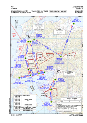
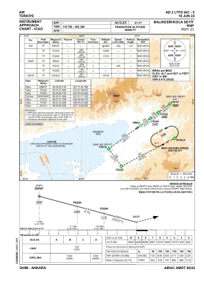
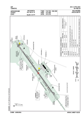


LTFD - Balikesir Koca Seyit
Located in Balikesir, Turkey
ICAO - LTFD, IATA - EDO
Data provided by AirmateGeneral information
Coordinates: N39°33'9" E27°0'37"
Elevation is 51 feet MSL.
Magnetic variation is 4.9° East View others Airports in Balikesir
Operational data
Special qualification required
Current time UTC:
Current local time:
Weather
METAR: LTFD 080850Z 24007KT 9999 FEW035 25/11 Q1015
TAF: TAF AMD LTFD 080743Z 0807/0815 VRB02KT 9999 FEW035 SCT200
Communications frequencies: [VIEW]
Runways:
| RWY identifier | QFU | Length (ft) | Width (ft) | Surface | LDA (ft) |
| 05 | 54° | 9843 | 148 | CONC | 9843 |
| 23 | 234° | 9843 | 148 | CONC | 8858 |
Airport contact information
Address: Balikesir Turkey