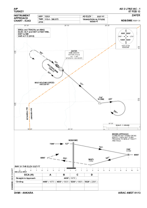
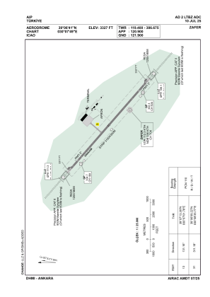


LTBZ - Zafer
Located in Kutahya, Turkey
ICAO - LTBZ, IATA - KZR
Data provided by AirmateGeneral information
Coordinates: N39°6'41" E30°7'49"
Elevation is 3327 feet MSL.
Magnetic variation is 5.2° East View others Airports in Manisa
Operational data
Special qualification required
Current time UTC:
Current local time:
Weather
TAF: TAF LTBZ 011940Z 0121/0206 VRB02KT 9999 BKN030
Communications frequencies: [VIEW]
Runways:
| RWY identifier | QFU | Length (ft) | Width (ft) | Surface | LDA (ft) |
| 13 | 131° | 9843 | 148 | CONC | 9843 |
| 31 | 311° | 9843 | 148 | CONC | 9843 |
Airport contact information
Address: Kutahya Turkey