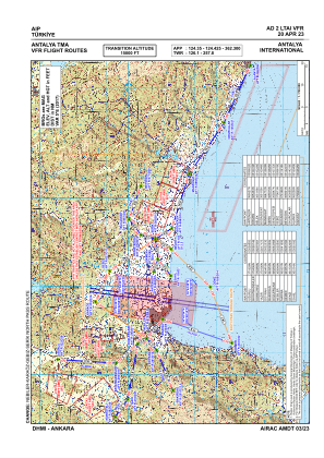
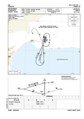
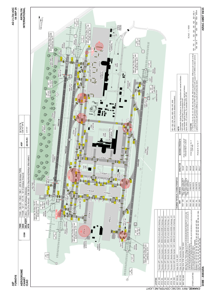


LTAI - Antalya
Located in Antalya, Turkey
ICAO - LTAI, IATA - AYT
Data provided by AirmateGeneral information
Coordinates: N36°54'1" E30°47'34"
Elevation is 177 feet MSL.
Magnetic variation is 5.0° East View others Airports in Antalya
Operational data
Special qualification required
Current time UTC:
Current local time:
Weather
METAR: LTAI 261350Z 15005KT 110V190 CAVOK 26/18 Q1007 NOSIG RMK RWY18C 16006KT 120V190 RWY36R 14005KT 090V200 RWY18L 18006KT 140V220
TAF: TAF LTAI 261040Z 2612/2712 16010KT CAVOK BECMG 2615/2618 34006KT PROB40 2622/2702 4000 BR SCT010 BECMG 2707/2710 18010KT
Communications frequencies: [VIEW]
Runways:
| RWY identifier | QFU | Length (ft) | Width (ft) | Surface | LDA (ft) |
| 18C | 186° | 11155 | 148 | CONC | 11155 |
| 36C | 6° | 11155 | 148 | CONC | 11155 |
| 18L | 186° | 11155 | 148 | CONC | 11155 |
| 36R | 6° | 11155 | 148 | CONC | 11155 |
| 18R | 186° | 9810 | 148 | ASPH | 9810 |
| 36L | 6° | 9810 | 148 | ASPH | 9810 |
Airport contact information
Address: Antalya Turkey