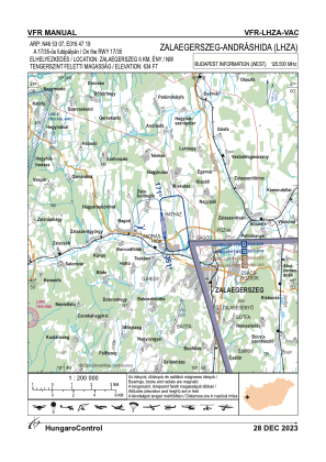
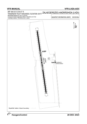


LHZA - Zalaegerszeg-Andrashida
Located in Zalaegerszeg, Hungary
ICAO - LHZA, IATA -
Data provided by AirmateGeneral information
Coordinates: N46°53'11" E16°47'19"
Elevation is 634 feet MSL.
View others Airports in Zala
Operational data
Special qualification required
Current time UTC:
Current local time:
Weather at : LHSM - Heviz-Balaton Airport ( 36 km )
METAR: LHSM 291345Z AUTO 13007KT 070V190 CAVOK 26/09 Q1022 NOSIG
TAF: TAF LHSM 291115Z 2912/2921 12009KT CAVOK
Communications frequencies: [VIEW]
Runways:
| RWY identifier | QFU | Length (ft) | Width (ft) | Surface | LDA (ft) |
| 17 | 0° | 4921 | 82 | GRASS | |
| 35 | 0° | 4921 | 82 | GRASS |
Airport contact information
Address: Zalaegerszeg Hungary