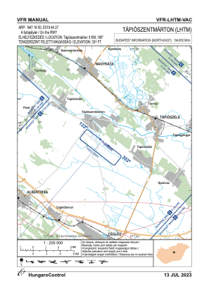
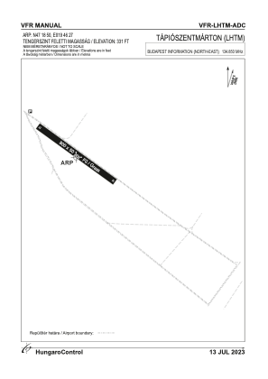


LHTM - Tapioszentmarton
Located in Tapioszentmarton, Hungary
ICAO - , IATA -
Data provided by AirmateGeneral information
Coordinates: N47°18'49" E19°46'26"
Elevation is 341 feet MSL.
View others Airports in Pest
Operational data
Special qualification required
Current time UTC:
Current local time:
Weather at : LHSN - Szolnok ( 41 km )
METAR: LHSN 261945Z VRB02KT CAVOK 12/07 Q1014 NOSIG RMK BLU
TAF: TAF LHSN 261715Z 2618/2703 14006KT CAVOK
Communications frequencies: [VIEW]
Runways:
| RWY identifier | QFU | Length (ft) | Width (ft) | Surface | LDA (ft) |
| 31 | 0° | 2625 | 164 | GRASS | |
| 13 | 0° | 2625 | 164 | GRASS |
Airport contact information
Address: Tapioszentmarton Hungary