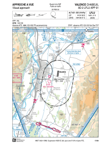


LFLU - Valence Chabeuil
Located in Valence, France
ICAO - LFLU, IATA - VAF
Data provided by AirmateGeneral information
Coordinates: N44°54'56" E4°58'7"
Elevation is 525 feet MSL.
Magnetic variation is 1.86° East View others Airports in Rhône Alpes
Operational data
Special qualification required
Current time UTC:
Current local time:
Communications frequencies: [VIEW]
Runways:
| RWY identifier | QFU | Length (ft) | Width (ft) | Surface | LDA (ft) |
| 01L | 8° | 3904 | 164 | GRASS | 3904 |
| 19R | 188° | 3904 | 164 | GRASS | 3904 |
| 01R | 8° | 1312 | 197 | GRASS | 1312 |
| 19L | 188° | 1312 | 197 | GRASS | 1312 |
| 01 | 8° | 6890 | 148 | ASPH | 6053 |
| 19 | 188° | 6890 | 148 | ASPH | 6480 |
Airport contact information
Address: Valence France