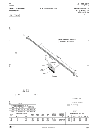


LFCC - Cahors Lalbenque
Located in Cahors, France
ICAO - LFCC, IATA - ZAO
Data provided by AirmateGeneral information
Coordinates: N44°21'2" E1°28'43"
Elevation is 912 feet MSL.
Magnetic variation is 0.97° East View others Airports in Midi-Pyrénées
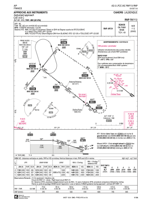
Operational data
Special qualification required
Current time UTC:
Current local time:
Communications frequencies: [VIEW]
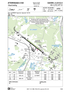
Runways:
| RWY identifier | QFU | Length (ft) | Width (ft) | Surface | LDA (ft) |
| 13L | 128° | 3543 | 164 | GRASS | 3543 |
| 31R | 308° | 3543 | 164 | GRASS | 3543 |
| 13 | 128° | 4921 | 98 | ASPH | 4921 |
| 31 | 308° | 4921 | 98 | ASPH | 4921 |
Airport contact information
Address: Cahors France


