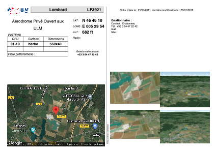


LF3921 - Lombard
Located in Lombard, France
ICAO - , IATA -
Data provided by AirmateGeneral information
Coordinates: N46°46'10" E5°29'54"
Elevation is 682 feet MSL.
View others Airports in Franche-Comté
Operational data
Special qualification required
Current time UTC:
Current local time:
Weather at : LFGJ - Dole Tavaux ( 31 km )
METAR: LFGJ 080100Z AUTO 36007KT CAVOK 11/10 Q1020
TAF: TAF LFGJ 071401Z 0715/0724 36009KT 9999 SCT035 BKN060 TEMPO 0715/0718 -SHRA SCT030TCU PROB30 TEMPO 0715/0717 5000 SHRA SCT030CB
Communications frequencies: [VIEW]
Runways:
| RWY identifier | QFU | Length (ft) | Width (ft) | Surface | LDA (ft) |
| 01 | 0° | 1804 | 131 | GRASS | |
| 19 | 0° | 1804 | 131 | GRASS |
Airport contact information
Address: Lombard France