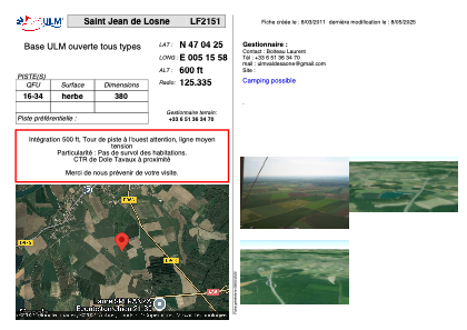


LF2151 - Saint Jean de Losne
Located in Losne, France
ICAO - , IATA -
Data provided by AirmateGeneral information
Coordinates: N47°4'25" E5°15'58"
Elevation is 600 feet MSL.
View others Airports in Franche-Comté
Operational data
Special qualification required
Current time UTC:
Current local time:
Weather at : LFGJ - Dole Tavaux ( 13 km )
METAR: LFGJ 270430Z AUTO 08003KT CAVOK 19/16 Q1013
Communications frequencies: [VIEW]
Runways:
| RWY identifier | QFU | Length (ft) | Width (ft) | Surface | LDA (ft) |
| 16 | 0° | 1246 | 0 | GRASS | |
| 34 | 0° | 1246 | 0 | GRASS |
Airport contact information
Address: Losne France