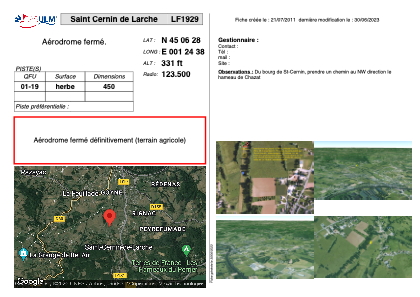


LF1929 - Saint Cernin de Larche
Located in Saint-Cernin-de-l'Arche, France
ICAO - , IATA -
Data provided by AirmateGeneral information
Coordinates: N45°6'28" E1°24'38"
Elevation is 331 feet MSL.
View others Airports in Limousin
Operational data
Special qualification required
Current time UTC:
Current local time:
Weather at : LFSL - Brive Souillac ( 10 km )
METAR: LFSL 281800Z AUTO 32004KT 290V010 CAVOK 17/05 Q1014 NOSIG
TAF: TAF LFSL 281400Z 2815/2824 VRB03KT 9999 FEW040 BECMG 2815/2817 CAVOK
Communications frequencies: [VIEW]
Runways:
| RWY identifier | QFU | Length (ft) | Width (ft) | Surface | LDA (ft) |
| 01 | 0° | 1476 | 0 | GRASS | |
| 19 | 0° | 1476 | 0 | GRASS |
Airport contact information
Address: Saint-Cernin-de-l'Arche France