


KMMH - Mammoth Yosemite
Located in Mammoth Lakes, United States
ICAO - MMH, IATA - MMH
Data provided by AirmateGeneral information
Coordinates: N37°37'27" W118°50'20"
Elevation is 7134 feet MSL.
Magnetic variation is 15° East View others Airports in California
Operational data
Special qualification required
Current time UTC:
Current local time:
Weather
METAR: KMMH 261415Z AUTO 27015G32KT 10SM CLR 06/M09 A2989 RMK AO2 T00571093
TAF: KMMH 261120Z 2612/2712 29016G22KT P6SM OVC100 FM261300 30016G30KT P6SM VCSH BKN050 OVC100 FM270400 33008KT P6SM SCT050 BKN100
Communications frequencies: [VIEW]
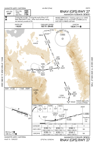
Runways:
| RWY identifier | QFU | Length (ft) | Width (ft) | Surface | LDA (ft) |
| 09 | 109° | 7000 | 100 | ASPH | 7000 |
| 27 | 289° | 7000 | 100 | ASPH | 7000 |
Airport contact information
Address: Mammoth Lakes United States