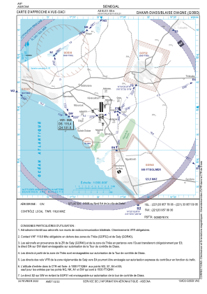
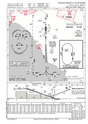
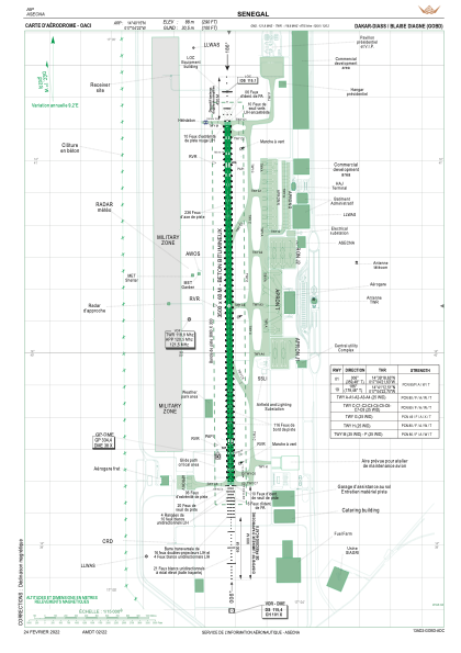


GOBD - Aeroport Intl Blaise Diagne - Dakar - Diass
Located in Dakar, Senegal
ICAO - , IATA - DSS
Data provided by AirmateGeneral information
Coordinates: N14°40'15" W17°4'22"
Elevation is 290 feet MSL.
Magnetic variation is -6° East View others Airports in Dakar
Operational data
Special qualification required
Current time UTC:
Current local time:
Weather
METAR: GOBD 231200Z 34003KT 270V020 8000 NSC 32/18 Q1013 NOSIG
TAF: TAF GOBD 231100Z 2312/2418 27006KT 800 NSC
Communications frequencies: [VIEW]
Runways:
| RWY identifier | QFU | Length (ft) | Width (ft) | Surface | LDA (ft) |
| 01 | 360° | 11483 | 197 | CONC | 11483 |
| 19 | 180° | 11483 | 197 | CONC | 11483 |
Airport contact information
Address: Dakar Senegal