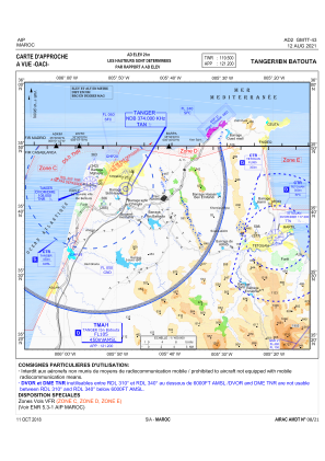
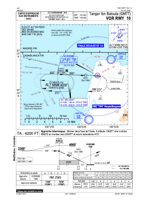
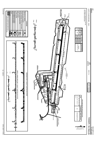


GMTT - Tanger Ibn Batouta
Located in Tanger, Morocco
ICAO - GMTT, IATA - TNG
Data provided by AirmateGeneral information
Coordinates: N35°43'54" W5°55'16"
Elevation is 68 feet MSL.
Magnetic variation is -1° East View others Airports in Tanger
Operational data
Special qualification required
Current time UTC:
Current local time:
Weather
METAR: GMTT 270200Z 18006KT 130V220 8000 SCT020 BKN026 15/14 Q1006 NOSIG
TAF: TAF GMTT 262300Z 2700/2806 20008KT 8000 SCT020 BKN026 TEMPO 2704/2710 20015G25KT 2500 SHRA SCT013 SCT020TCU BKN026
Communications frequencies: [VIEW]
Runways:
| RWY identifier | QFU | Length (ft) | Width (ft) | Surface | LDA (ft) |
| 10 | 97° | 9774 | 142 | ASPH | 11483 |
| 28 | 277° | 9774 | 142 | ASPH | 9843 |
Airport contact information
Address: Tanger Morocco