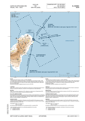
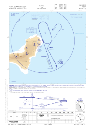
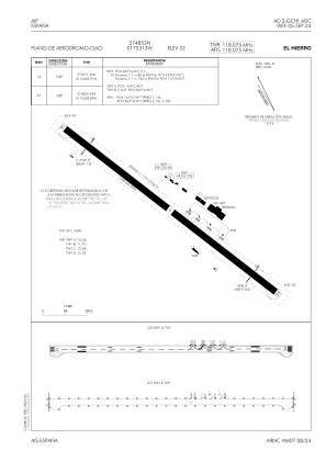


GCHI - El Hierro
Located in Hierro, Spain
ICAO - GCHI, IATA - VDE
Data provided by AirmateGeneral information
Coordinates: N27°48'53" W17°53'13"
Elevation is 104 feet MSL.
Magnetic variation is -5° East View others Airports in Canary Islands
Operational data
Special qualification required
Current time UTC:
Current local time:
Weather
METAR: GCHI 070100Z AUTO 35012KT 9999 BKN013 21/18 Q1015
TAF: TAF AMD GCHI 062210Z 0622/0721 36010KT 9999 SCT020 TX25/0714Z TN20/0706Z TEMPO 0713/0718 15010KT PROB40 TEMPO 0711/0714 06010KT PROB30 TEMPO 0622/0707 BKN010
Communications frequencies: [VIEW]
Runways:
| RWY identifier | QFU | Length (ft) | Width (ft) | Surface | LDA (ft) |
| 16 | 153° | 4101 | 98 | ASPH | 4101 |
| 34 | 333° | 4101 | 98 | ASPH | 4101 |
Airport contact information
Address: Hierro Spain