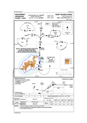
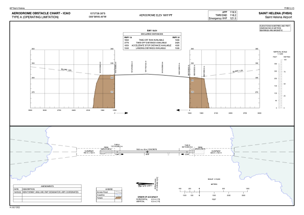


FHSH - St Helena Airport
Located in St. Helena, Saint Helena
ICAO - , IATA - HLE
Data provided by AirmateGeneral information
Coordinates: S15°57'29" W5°38'45"
Elevation is 1017 feet MSL.
Operational data
Special qualification required
Current time UTC:
Current local time:
Weather at : - ( 0 km )
METAR: PAPE 100852Z AUTO 12019G26KT 7SM -RA BKN009 BKN015 OVC023 03/02 A2966 RMK AO2 PK WND 13026/0850 UPB02E07RAB07SNE02 CIG 008V014 PRESFR P0022 400611017
Communications frequencies: [VIEW]
Runways:
| RWY identifier | QFU | Length (ft) | Width (ft) | Surface | LDA (ft) |
| 01 | 359° | 6398 | 148 | UNK | |
| 19 | 179° | 6398 | 148 | UNK |
Airport contact information
Address: St. Helena Saint Helena