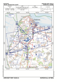
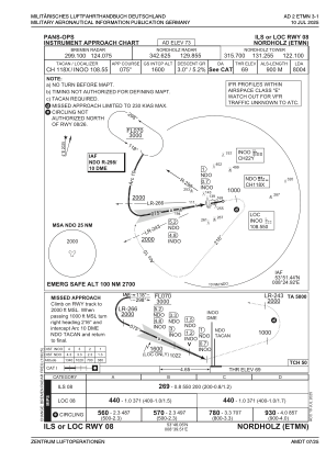
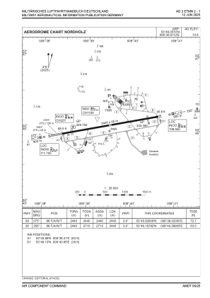


ETMN - Nordholz
Located in Nordholz, Germany
ICAO - ETMN, IATA - FCN
Data provided by AirmateGeneral information
Coordinates: N53°46'3" E8°39'31"
Elevation is 73 feet MSL.
Magnetic variation is 3.4° East View others Airports in Lower Saxony
Operational data
Special qualification required
Current time UTC:
Current local time:
Weather
METAR: ETMN 261420Z 28006KT 9999 FEW024 10/04 Q1004 BLU+BLU+
TAF: TAF ETMN 261333Z 2614/2623 29005KT 9999 NSW SCT020 SCT050 PROB30 2614/2619 30010G20KT 5000 -SHRA SCT010 BKN015TCU
Communications frequencies: [VIEW]
Runways:
| RWY identifier | QFU | Length (ft) | Width (ft) | Surface | LDA (ft) |
| 08 | 79° | 8004 | 148 | ASPH | 8004 |
| 26 | 259° | 8004 | 148 | ASPH | 8004 |
Airport contact information
Address: Nordholz Germany