


EPPG - Kakolewo
Located in , Poland
ICAO - , IATA -
Data provided by AirmateGeneral information
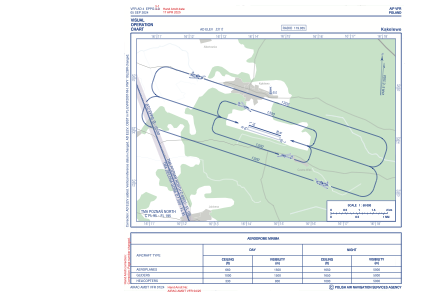
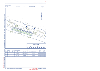
Coordinates: N52°14'6" E16°14'28"
Elevation is 323 feet MSL.
View others Airports in Greater Poland
Operational data
Special qualification required
Current time UTC:
Current local time:
Weather at : EPZG - Zielona Gora/Babimost ( 32 km )
METAR: EPZG 270430Z VRB01KT 9999 FEW065CB 02/02 Q1011
TAF: TAF EPZG 270301Z 2703/2712 VRB02KT CAVOK TEMPO 2709/2712 SCT045TCU
Communications frequencies: [VIEW]
Runways:
| RWY identifier | QFU | Length (ft) | Width (ft) | Surface | LDA (ft) |
| 10L | 105° | 7546 | 98 | CONC+ASPH | 6332 |
| 28R | 285° | 7546 | 98 | CONC+ASPH | 5118 |
| 10R | 106° | 3904 | 328 | GRASS | 3904 |
| 28L | 286° | 3904 | 328 | GRASS | 3904 |
Airport contact information
Address: Poland