


ENSR - Soerkjosen
Located in Soerkjosen, Norway
ICAO - ENSR, IATA - SOJ
Data provided by AirmateGeneral information
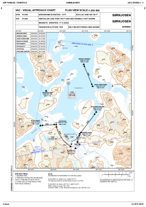
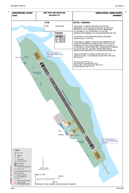
Coordinates: N69°47'12" E20°57'35"
Elevation is 16 feet MSL.
Magnetic variation is 10.7° East View others Airports in Troms
Operational data
Special qualification required
Current time UTC:
Current local time:
Weather
METAR: ENSR 022220Z AUTO 18004KT 150V220 9999 -RA SCT023/// OVC032/// 05/03 Q1022 RMK WIND RWY 32 16007KT WIND 1119FT 13010KT
TAF: TAF ENSR 021100Z 0212/0219 VRB03KT 9999 -RA FEW030 BKN040
Communications frequencies: [VIEW]
Runways:
| RWY identifier | QFU | Length (ft) | Width (ft) | Surface | LDA (ft) |
| 14 | 0° | 3327 | 98 | UNK | |
| 32 | 0° | 3327 | 98 | UNK |
Airport contact information
Address: Soerkjosen Norway