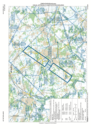
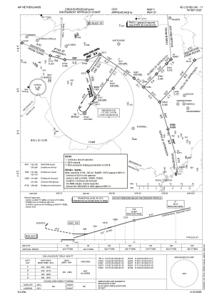
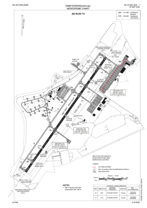


EHEH - Eindhoven
Located in Eindhoven, Netherlands
ICAO - EHEH, IATA - EIN
Data provided by AirmateGeneral information
Coordinates: N51°27'0" E5°22'28"
Elevation is 74 feet MSL.
Magnetic variation is +1.833° East View others Airports in Noord-Brabant
Operational data
Special qualification required
Current time UTC:
Current local time:
Weather
METAR: EHEH 291755Z AUTO 13004KT 080V230 9999 OVC160 18/07 Q1018 BLU NOSIG
TAF: TAF EHEH 291710Z 2918/3024 17007KT CAVOK PROB40 TEMPO 3002/3009 4500 -RA SCT018 BKN030 BECMG 3009/3011 11008KT BECMG 3018/3020 VRB02KT
Communications frequencies: [VIEW]
Runways:
| RWY identifier | QFU | Length (ft) | Width (ft) | Surface | LDA (ft) |
| 03 | 35° | 10039 | 148 | ASPH | 9022 |
| 21 | 215° | 10039 | 148 | ASPH | 9022 |
Airport contact information
Address: Eindhoven Netherlands


