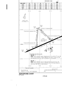


CYTB - Tillsonburg
Located in , Canada
ICAO - , IATA -
Data provided by AirmateGeneral information
Coordinates: N42°55'35" W80°44'49"
Elevation is 893 feet MSL.
Magnetic variation is -9° East View others Airports in Ontario
Operational data
Special qualification required
Current time UTC:
Current local time:
Weather at : CYXU - London ( 35 km )
METAR: CYXU 262300Z 08018KT 15SM SCT220 OVC270 13/M01 A3022 RMK CS3CI5 SLP244
TAF: TAF CYXU 261740Z 2618/2718 12010G20KT P6SM SKC FM270300 10010G20KT P6SM BKN210 FM270600 15010G20KT P6SM FEW060 OVC140 FM271100 17015G25KT P6SM -SHRA OVC030 FM271500 19018G28KT 6SM -SHRA BR OVC025 PROB30 2715/2718 2SM SHRA BR OVC020 RMK NXT FCST BY 270000Z
Communications frequencies: [VIEW]
Runways:
| RWY identifier | QFU | Length (ft) | Width (ft) | Surface | LDA (ft) |
| 08 | 66° | 5502 | 100 | ASPH | 5502 |
| 26 | 246° | 5502 | 100 | ASPH | 4502 |
| 02 | 5° | 2348 | 75 | GRASS | 2248 |
| 20 | 185° | 2348 | 75 | GRASS | 2248 |
| 14 | 131° | 2258 | 75 | GRASS | 1958 |
| 32 | 311° | 2258 | 75 | GRASS | 2158 |
Airport contact information
Address: Canada
