


7W5 - Henry County
Located in Napoleon, United States
ICAO - 7W5, IATA -
Data provided by AirmateGeneral information
Coordinates: N41°22'27" W84°4'4"
Elevation is 683 feet MSL.
Magnetic variation is -05° East View others Airports in Ohio
Operational data
Special qualification required
Current time UTC:
Current local time:
Weather at : KUSE - Fulton County ( 27 km )
METAR: KUSE 270415Z AUTO 08005KT 10SM SCT050 OVC055 11/11 A3003 RMK AO2
Communications frequencies: [VIEW]
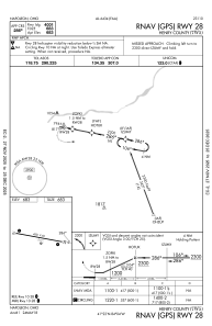
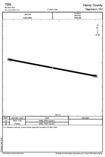
Runways:
| RWY identifier | QFU | Length (ft) | Width (ft) | Surface | LDA (ft) |
| 10 | 101° | 4001 | 60 | ASPH | |
| 28 | 281° | 4001 | 60 | ASPH |
Airport contact information
Address: Napoleon United States