
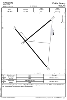


KINK - Winkler County
Located in Wink, United States
ICAO - INK, IATA - INK
Data provided by AirmateGeneral information
Coordinates: N31°46'47" W103°12'6"
Elevation is 2821 feet MSL.
Magnetic variation is 08° East View others Airports in Texas
Operational data
Special qualification required
Current time UTC:
Current local time:
Communications frequencies: [VIEW]
Runways:
| RWY identifier | QFU | Length (ft) | Width (ft) | Surface | LDA (ft) |
| 04 | 50° | 3514 | 100 | ASPH | |
| 22 | 230° | 3514 | 100 | ASPH | |
| 13 | 140° | 5003 | 100 | ASPH | |
| 31 | 320° | 5003 | 100 | ASPH |
Airport contact information
Address: Wink United States