


LTBA - Istanbul Ataturk
Located in Istanbul, Turkey
ICAO - LTBA, IATA - ISL
Data provided by AirmateGeneral information
Coordinates: N40°58'34" E28°48'51"
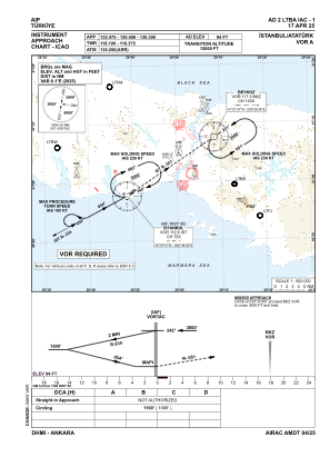
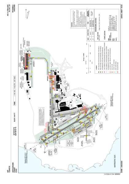
Elevation is 94 feet MSL.
Magnetic variation is 5.4° East View others Airports in Istanbul
Operational data
Special qualification required
Current time UTC:
Current local time:
Weather at : LTFM - Istanbul ( 34 km )
METAR: LTFM 021020Z 24009KT 180V270 CAVOK 31/11 Q1017 NOSIG RMK RWY17L 22008KT 160V270 RWY34L 20008KT 160V240 RWY16R 20007KT 160V240 RWY36 21010KT RWY18 21010KT 180V250
TAF: TAF LTFM 020440Z 0206/0312 21010KT CAVOK BECMG 0209/0212 05010KT BECMG 0216/0219 16005KT BECMG 0303/0306 06010KT
Communications frequencies: [VIEW]
Runways:
| RWY identifier | QFU | Length (ft) | Width (ft) | Surface | LDA (ft) |
| 05 | 59° | 8465 | 197 | ASPH | 8038 |
| 23 | 239° | 8465 | 197 | ASPH | 8465 |
Airport contact information
Address: Istanbul Turkey