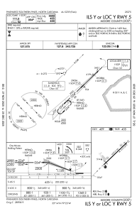


KSOP - Moore County
Located in Pinehurst/Southern Pines, United States
ICAO - SOP, IATA -
Data provided by AirmateGeneral information
Coordinates: N35°14'15" W79°23'21"
Elevation is 459 feet MSL.
Magnetic variation is -08° East View others Airports in North Carolina
Operational data
Special qualification required
Current time UTC:
Current local time:
Weather
METAR: KSOP 082232Z AUTO 25010G18KT 10SM VCTS -RA FEW030 BKN046 OVC100 22/17 A2984 RMK AO2 PK WND 25032/2212 LTG DSNT ALQDS TSB21RAB2159 P0000
Communications frequencies: [VIEW]
Runways:
| RWY identifier | QFU | Length (ft) | Width (ft) | Surface | LDA (ft) |
| 05 | 46° | 6503 | 150 | ASPH | 5502 |
| 23 | 226° | 6503 | 150 | ASPH | 5722 |
Airport contact information
Address: Pinehurst/Southern Pines United States
