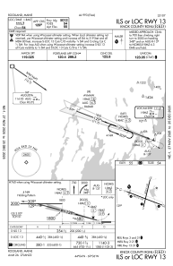


KRKD - Knox County Rgnl
Located in Rockland, United States
ICAO - RKD, IATA - RKD
Data provided by AirmateGeneral information
Coordinates: N44°3'37" W69°5'59"
Elevation is 55 feet MSL.
Magnetic variation is -18° East View others Airports in Maine
Operational data
Special qualification required
Current time UTC:
Current local time:
Weather
METAR: KRKD 021348Z AUTO 24004KT 9SM -RA SCT003 OVC080 08/07 A3002 RMK AO2 P0002
TAF: KRKD 021338Z 0214/0312 21004KT P6SM -RA BKN003 OVC080 FM022200 11005KT 6SM -SHRA BR BKN005 FM030200 VRB03KT P6SM BKN005 FM030900 02003KT P6SM BKN008
Communications frequencies: [VIEW]
Runways:
| RWY identifier | QFU | Length (ft) | Width (ft) | Surface | LDA (ft) |
| 03 | 13° | 4000 | 100 | ASPH | 4000 |
| 21 | 193° | 4000 | 100 | ASPH | 4000 |
| 13 | 111° | 5412 | 100 | ASPH | 5012 |
| 31 | 291° | 5412 | 100 | ASPH | 5412 |
Airport contact information
Address: Rockland United States